Discipline 02 · Surveying

Terrain, watercourse, structure.

We measure where the design begins: in the streambed, under the bridge, on the slope of the new development. You do not get a point cloud to sort out yourself but a clean file in your format and your coordinate system.

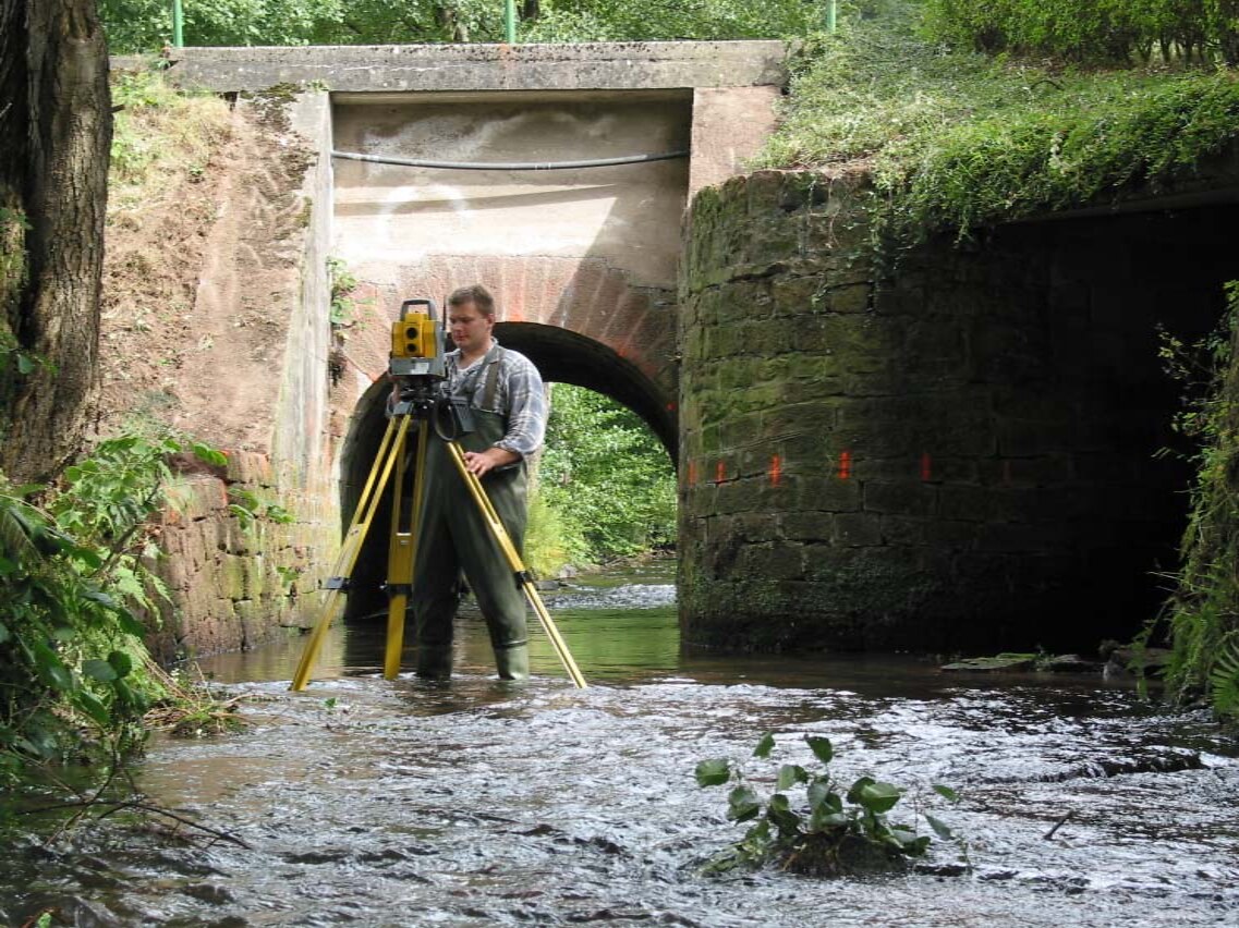
Surveyor with a total station on a tripod in the streambed under a bridge arch
Level
±0.3mm/km
Trimble DiNi 0.3 for settlement monitoring
Satellite
GNSS
GPS and GLONASS, centimetre accuracy in real time
Position / height
UTM32
ETRS89, heights DHHN2016 – or to your specification
Output
DWG
plus DXF, ASCII, GAF and PDF

What we do in detail

01

Topographic survey

Digital terrain models, cross sections, as-built drawings as a basis for design. We agree the density beforehand – a model for a flood simulation needs different spacing from a site plan.

Result: terrain model, profiles and as-built drawing in the agreed format.

02

River and structural surveying

Bed, water surface, bank line, weirs, bridges, culverts. Parts that are hard to reach we measure reflectorlessly – where nobody could hold a prism.

In GAF format too, where the authority requires it.

03

Rough and fine setting out

We transfer the approved design to the ground: excavation, axes, building corners, development areas. Rough before the dig, fine for the profile boards – usually two visits.

You receive a signed setting-out record.

04

Site surveying and quantities

Measurement during construction, quantity take-off for invoicing, control surveys. So that what was built can be evidenced at the end.

With interim figures for stage payments on request.

05

Settlement and deformation monitoring

Precision levelling with the DiNi 0.3 on structures and slopes, repeated at agreed intervals, with the time series evaluated.

Worth starting at the first suspicion, not after the crack.

06

As-built records and control networks

Final documentation after completion, GNSS control point networks for longer sites and repeat surveys.

Control points are described and handed over, not just set.

What you receive

Position and height

  • ETRS89 / UTM32 (standard)
  • heights DHHN2016
  • Gauss-Krüger on request
  • project-specific site networks

Formats

  • DWG and DXF for AutoCAD and LANDCAD
  • ASCII and CSV point lists
  • GAF profile files for watercourses
  • PDF drawings to pass on

Documentation

  • measurement record with accuracy stated
  • control point descriptions
  • signed setting-out record
  • photo documentation

Time

  • regional visits at short notice
  • data usually within a few working days
  • one contact from enquiry to file

What we need from you

The more of this you have, the sooner the quote arrives. If something is missing, we will tell you how to get it.

  • Location: address, parcel or coordinates
  • Purpose of the survey (design, permit, invoicing, as-built)
  • Preferred format and coordinate system
  • Existing drawings or earlier surveys
  • Access to the site and a contact person there

Frequent questions on this

01Can you deliver in our site network?

Yes. Give us the control points with coordinates and descriptions and we deliver directly in your system. Without a network we measure in ETRS89/UTM32 with heights in DHHN2016.

02How quickly can setting out be arranged?

Regional single visits in the Odenwald can usually be scheduled within one or two weeks. The condition is an approved site plan – nobody sets out responsibly without one.

03Do you also do the official cadastral building survey?

No. Recording a building in the land cadastre is a sovereign task reserved for publicly appointed surveyors or the state land management office. We set out before construction; the cadastral survey afterwards is not ours.

Does this match your project?

Describe it in the form – three minutes. We reply within two working days with an assessment.