A concrete weir becomes a rock ramp.
Restoring continuity on the river Aar: the fixed weir at Oberneisen was an insurmountable barrier for fish and invertebrates. WMEC redesigned it as a rough rock ramp – and saw the project through all nine HOAI service phases.
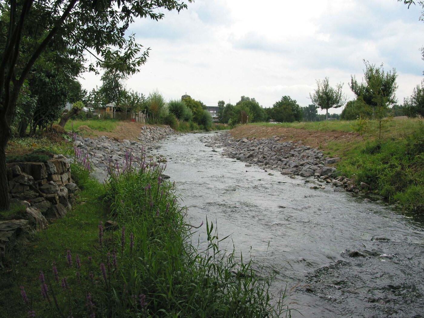
Same location, same view from downstream.
Before: a fixed concrete weir with a drop of 1.30 m. For fish migrating upstream it was a wall – only a few strong individuals made it past. The result: the population upstream declined and the aquatic community tipped out of balance.
After: a rough rock ramp with a 1:40 gradient, a parabolic channel and three bed-level boulder sills. The governing head difference falls to 0.80 m spread over 52 m – passable for all species, at low water and at flood.
Drag the slider to compare.
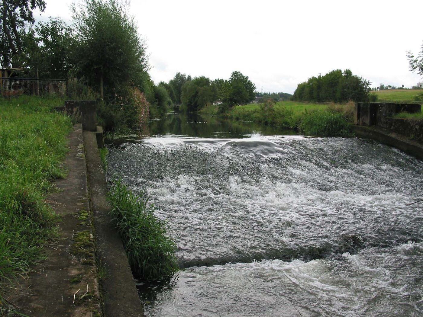 Before · concrete weirAfter · rock ramp
The figures behind the ramp.
A rock ramp has to do two things at once: provide enough depth and low flow velocity for fish at low water – and stay stable at the design discharge of 46.61 m³/s. The parabolic channel, raised by 22 cm, concentrates the flow in the middle when there is little water; the three boulder sills stabilise the bed and create resting zones.
The basis was our own river survey and the hydraulic calculation of the water surface profiles – both from one office, with no loss at the interface.
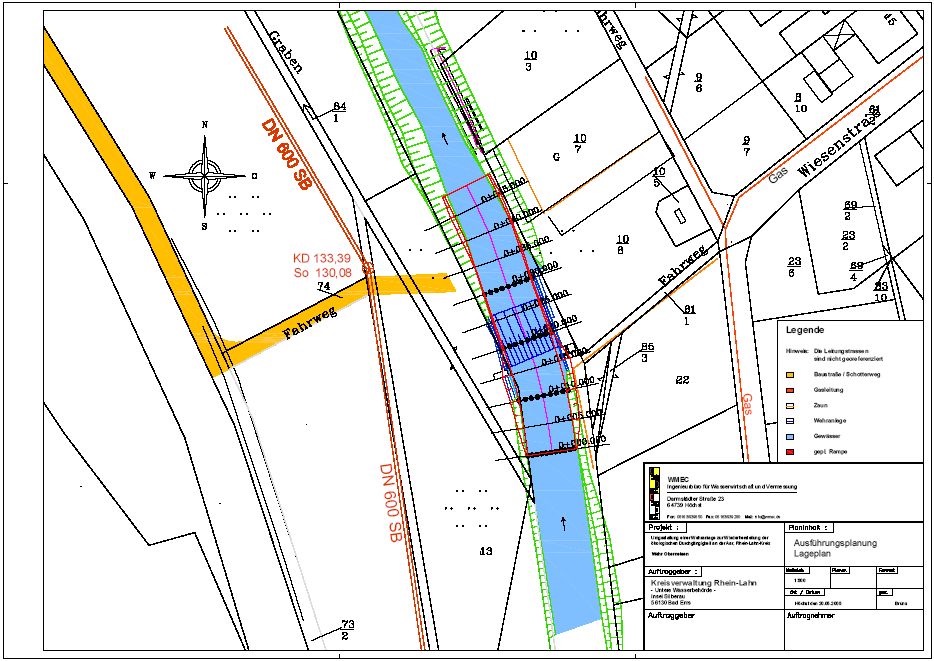
Site plan 1 : 500 – drawn by WMEC.
Weir, planned ramp, site road, DN 600 gas main and parcel boundaries in a single drawing. The basis for tendering, the authority and the contractor.
From survey to handover – from one office.
For the client that means one point of contact, one contract and no friction between surveying, hydraulics, design and site supervision. Six weeks of construction – in summer, at low water.
- PHASES 1–2River survey & basics
Recording the weir, bed, banks and cross sections above and below. Determining the design discharge.
- PHASE 3Hydraulic calculation & design
Water surface profiles for low, mean and flood flow. Setting the 1:40 gradient, ramp width and boulder sills.
- PHASE 4Permitting
Application documents for the lower water authority – here also the client.
- PHASES 5–7Detailed design & tendering
Site plan 1:500, detail drawings, bill of quantities, tendering and award of the construction works.
- JUNE – AUGUST 2005Site supervision (phase 8)
Removal of the concrete weir, construction of the ramp in the low-water window, setting out and control surveys by WMEC.
- PHASE 9Handover & documentation
Final account €52,857.33 gross. As-built documentation for the client.
A similar project on your watercourse?
Continuity, a Water Framework Directive measure, a weir conversion – we will tell you within two working days how we would approach it.