A new stream beside the weir.
The weir at the Pfeiffersmühle in Diez stays where it is – and the Aar still regains its continuity: through a 75 m near-natural bypass channel with an inlet structure of sheet piling and gabions. The old, non-functioning fish ladder was demolished.
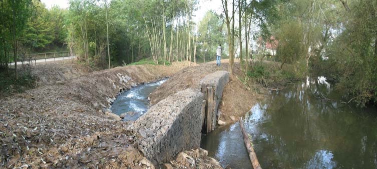
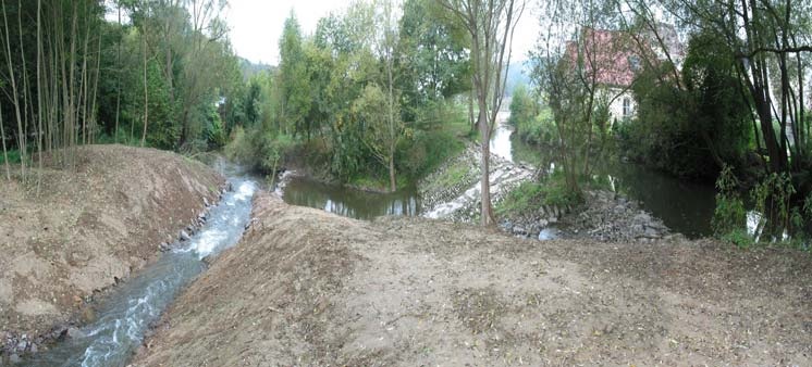
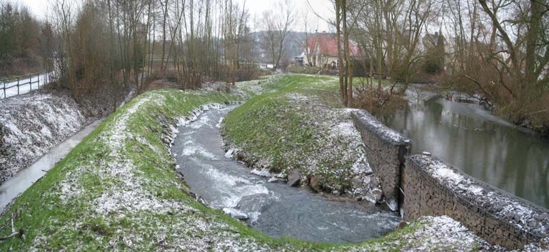
Construction, completion, first winter.
A bypass channel only becomes a stream over time. The panoramas show how the channel settles into the floodplain.
Why a bypass channel – and not a fish ladder?
The existing fish ladder did not work: too steep, too little water, impassable for many species. At the same time the side weir serving the mill and the flood relief had to be kept.
The solution: a near-natural stream running parallel to the weir. 75 m of channel spread the head difference of 1.98 m over a gradient of 1:40 – shallow enough for fish, with a flow depth of 0.40–0.60 m and a bed width of 0.75 m. In the outlet section the gradient steepens to 1:30 so the channel joins the Aar cleanly.
The inlet structure of sheet piling secures the branch against floods; the gabion cladding blends it into the bank. Boulder sills in the Aar create the attraction flow by which fish find the inlet.
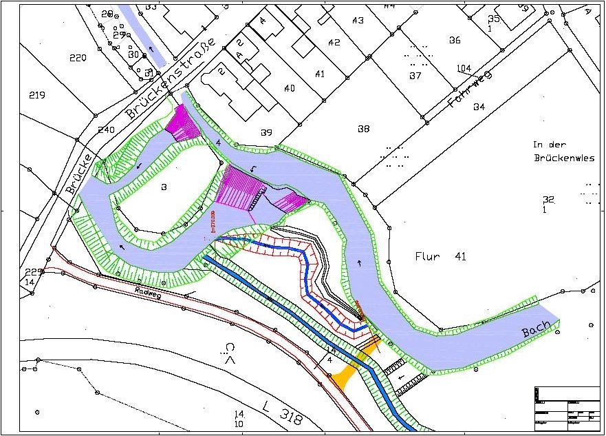
Everything on one sheet: weir, mill race, channel, flood.
The site plan shows how the structures at the Pfeiffersmühle work together: the side weir and the mill race inlet are retained, the fish ladder is demolished, and the new bypass channel branches off through the inlet structure and rejoins the Aar downstream.
In addition: a flood protection bund and a flood relief swale for high water, a temporary crossing and the site access from the L 318 road during construction.
- Mill race inlet · side weir · flood relief
- Fish ladder (demolished) · flood protection bund
- Bypass channel · inlet structure
- Flood relief swale · temporary crossing · access from L 318
Keep the weir, restore continuity?
We check whether a channel, a ramp or a fish pass suits your structure – with figures.